|
|

Diagnostic Data Sets
The diagnostic
data set comprises spatial subsets computed from Level-2 input
and Level-3 output products. The spatial subsets are stored in
netCDF files, called DDS granules. The granules cover areas of
about 100x100 km square.
The following
table describes the three kinds of available DDS products. Two
sets are computed from level 2 products (at 1 km PC and 4.6 km
ISIN resolutions) and one set is computed from the merged level
3 products (at 4.6 ISIN resolution).
|
Spatial
domain
|
Grid
|
Temporal
domain
|
Resolution
|
Merging
level
|
|
Local
|
ISIN
|
Daily,
8 days, monthly
|
1/24
|
Merged
data
|
|
Local
|
PC
|
Track
|
1.0
km
|
Single
instrument
|
|
Local
|
ISIN
|
Track
|
1/24
|
Single
instrument
|
|
IMPORTANT
NOTICE
All images and data available on this GlobColour website
are for research and educational use only
|
Web portal to access Ocean-Colour satellite-based data sets

GlobColour Full Product Set (fps)
GlobColour Diagnostic Data Sets (dds)
GlobColour NRT Service (nrt)
GlobColour Demonstration products
|

The DDS files are also accessible via a dedicated FTP
service.
Use server ftp.acri.fr ,
login globcolour_data ,
password fgh678
for log-in.
Goto directory DDS
The ftp directory structure (for not merged products) is described below:
/product
type (DDS)
/region of interest (DDS acronyms)
/INPUT
/instrument (MERIS,
MODIS, SEAWIFS)
/year
(1997-2006)
/TRACK or DAY
/products
(L3m...)
The ftp directory structure (for merged products) is described below:
/product
type (DDS)
/region of interest (DDS acronyms)
/MERGED
/merging mode (WEIGHTED
| GMS | SIMPLE)
/year
(1997...)
/DAY
/products
(L3m...)
|
|
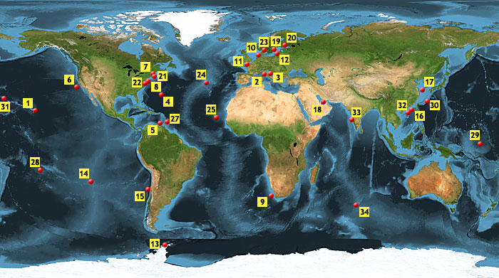
Diagnostic Sites
|
*
The site NIVA Ferry Box use the format: "Site-ID Site-Name Location Lat.C Lat.A Lat.B Lon.C Lon.A Lon.B" with:
• C corresponds to the reference
location of the DDS
• A corresponds to the top left
corner of the DDS
• B corresponds to the bottom right
corner of the DDS |
| |
23 |
|
NIVA Ferry Box
|
|
Skagerrak |
|
58.5 N |
60 N |
57 N |
10.5 E |
10 E |
11 E |
| Download the diagnostic sites
table in TXT, XLS
or CSV format. |
The European Service for Ocean Colour - GlobColour is an ESA Data User
Element Project
|