|
|
|
|
|
GlobColour demonstration products
Several demonstration products have been generated for testing
and user feedback.
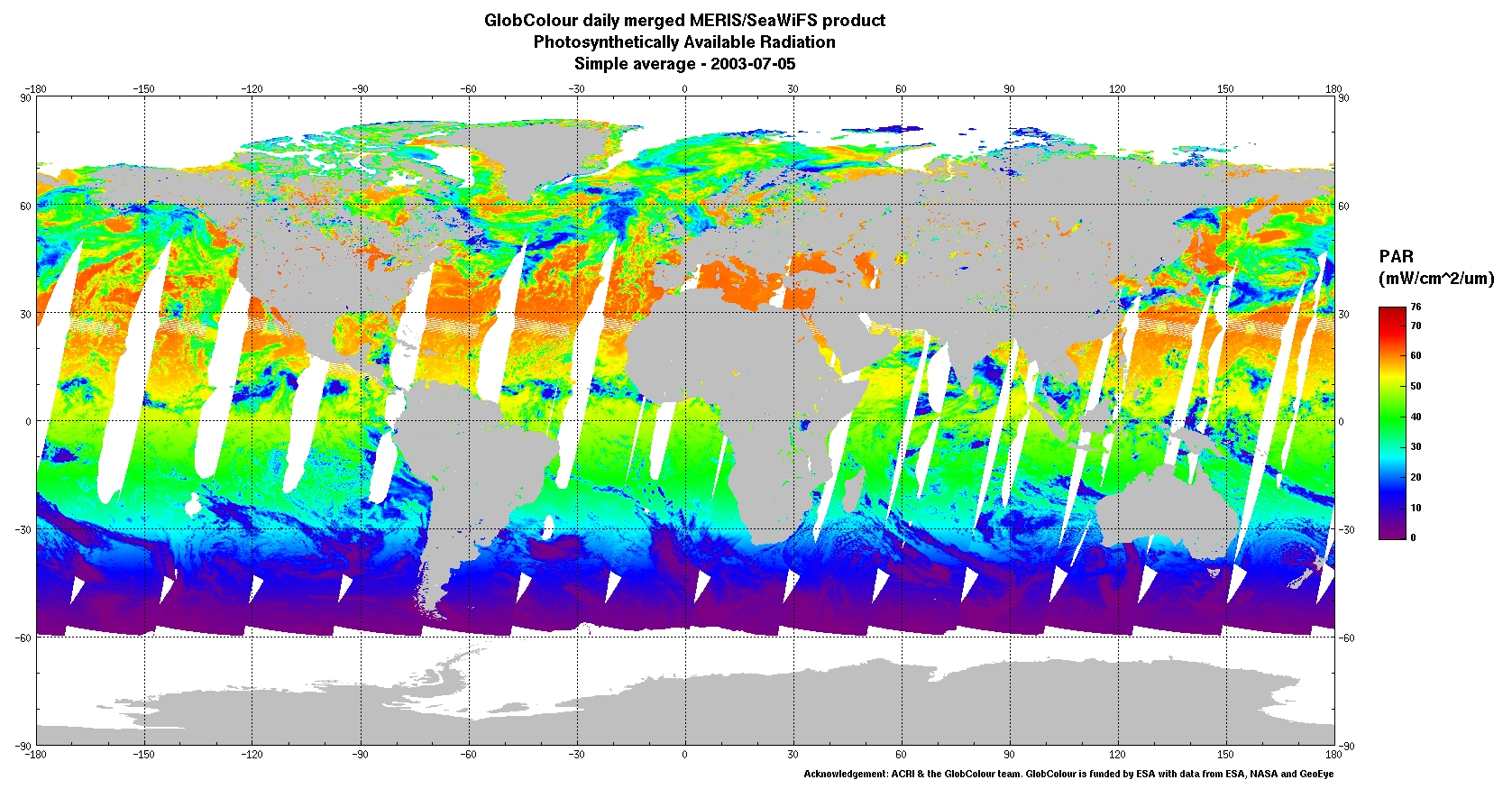
Photosynthetically Active Radiation (PAR)
A daily PAR estimate is obtained for each instantaneous pixel,
assuming the cloud/surface system is stable during the day and
corresponds to the satellite observation. Daily PAR estimates
obtained separately from different orbits and individual sensors
are binned using a simple, linear averaging scheme (arithmetical
mean).
The GlobColour PAR demonstration product is based on a merged
MERIS/SeaWiFS PAR product.
Reference:
Frouin, R., "The MEaSUREs PAR Project", OCRT Meeting, 4-6 may
2009, New York, NY
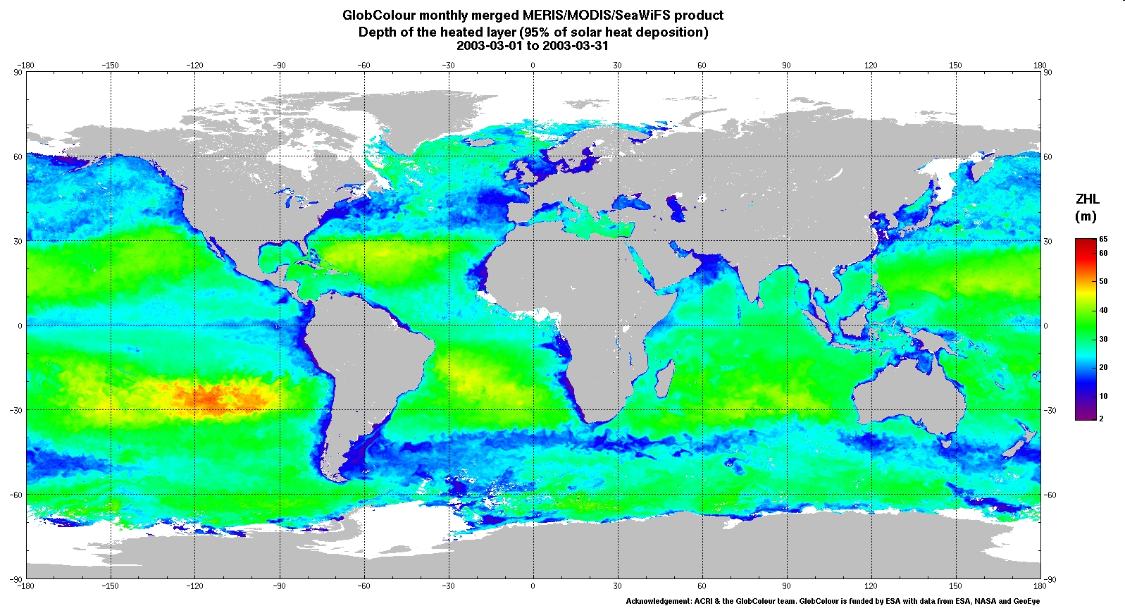
Heated layer depth Reference:
Morel, A., Huot, Y., Gentili, B., Werdell, P.J., Hooker,
S.B. and B.A. Franz (2007). Examining the consistency of
products derived from various ocean color sensors in open ocean
(Case 1) waters in the perspective of a multi-sensor
approach. Remote Sensing of Environment, 111, 69-88.
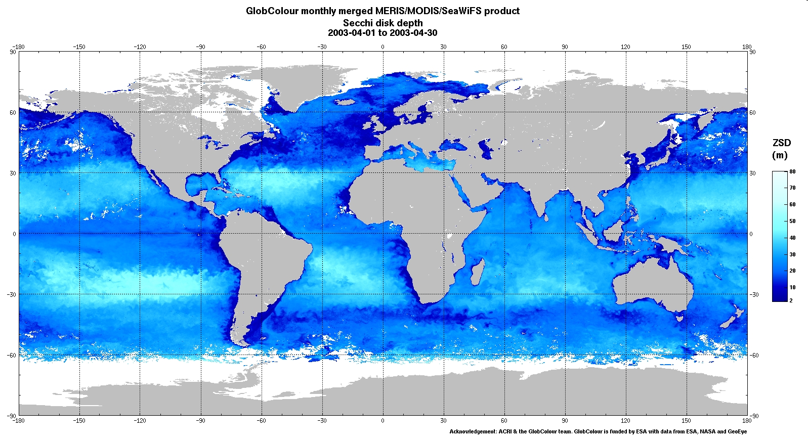
Secchi disk depth Products for year 2003 and daily NRT demonstration products using MERIS and MODIS data are available. References: Morel, A., Huot, Y., Gentili, B., Werdell, P.J., Hooker, S.B. and B.A. Franz (2007). Examining the consistency of products derived from various ocean color sensors in open ocean (Case 1) waters in the perspective of a multi-sensor approach. Remote Sensing of Environment, 111, 69-88. Doron, M., Babin, M., Mangin, A. and O. Fanton d'Andon (2006). Estimation of light penetration, and horizontal and vertical visibility in oceanic and coastal waters from surface reflectance. Journal of Geophysical Research, volume 112, C06003, doi: 10.1029/2006JC004007.
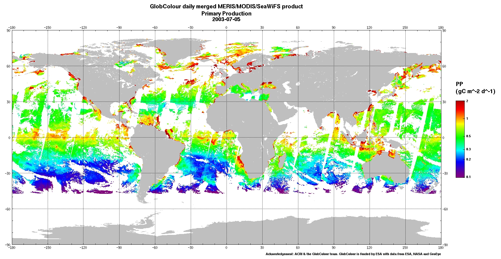
Primary Production The one year demonstration products have been generated using the following products as inputs:
Antoine, D. and A. Morel (1996). Oceanic primary production: I. Adaptation of a spectral light-photosynthesis model in view of application to satellite chlorophyll observations, Global Biogeochemical Cycles, 10, 43-55. Antoine, D., André J.M. and A. Morel (1996). Oceanic primary production: II. Estimation at global scale from satellite (Coastal Zone Color Scanner) chlorophyll, Global Biogeochemical Cycles, 10, 57-69.
|