|
|
|
|
|
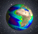
The ocean makes up nearly 70% of the Earth's surface. Hence, an understanding of the cycling of carbon by the ocean biosphere is critical for developing scientifically based response to the sequestration of anthropogenic carbon emissions. ESA has one mission aboard ENVISAT: the Medium Resolution Imaging Spectrometer Instrument (MERIS), NASA has three missions in orbit to assess ocean biological processes by measuring the colour of the sea , the Sea-viewing Wide Field of view Sensor (SeaWiFS) and two flight models of the Moderate Imaging Spectrometer (MODIS) on the Terra and Aqua Earth Observing System (EOS) missions and CNES has now launched a new POLDER on board Parasol. In the coming years, the VIIRS, on the NPOESS Preparatory Project (NPP) will be deployed while ESA will deploy the Sentinel GMES-1 mission. In addition to ESA and NASA, several international space agencies have planned and deployed satellite ocean color missions. As of today, there are 12 moderate resolution ocean color imagers in orbit (http://www.ioccg.org/sensors/polar.html) although many of these are pilot missions and do not produce research quality data. Clearly, there are many ocean color data products for researchers, educators, students and policy makers to choose from. These ocean colour missions have been developed to answer many of the most basic questions of how the ocean biosphere operates. Is the amount of vegetal biomass in the ocean increasing or decreasing in time? What is the role of climate change on the ocean biosphere? How do anthropogenic processes (in particular increasing atmospheric CO2) influence the ocean biosphere and can these changes be detected? It seems obvious that better ocean color data products will come from the merging of different data sets:
The differences and similarities of the spectral observations can be taken advantage of in the merging process leading to improved accuracy and measurable uncertainties (e.g., Siegel, 1998; Maritorena et al. 2002). Finally, the merging process must be well justified and documented so all users understand its implications. The latter points to the importance of unified climate data records of ocean color products with measured and documented uncertainties where the merging process is transparent for all users. Prior to GlobCOLOUR, several ocean color data merging initiatives have been conducted and they are briefly summarized below to present the scientific and contextual background of the project. The first real merging strategies have been debated and implemented during the NASA SIMBIOS project. Indeed, one of the primary goals of the SIMBIOS project was to develop and evaluate methods for the merging of data products from multiple ocean color missions. In parallel to SIMBIOS, one term of reference of the IOCCG indicates that the group shall "Facilitate merging and access to ocean-colour data" and
In 2003, as the MODIS-Terra oceans collection #4 reprocessing was generated, a demonstrator of ocean data merger was developed by the SIMBIOS project. It was based on the simplest form of merger to implement, which is the averaging of Level-3 products (here Chlorophyll) from multiple sensors into geo-located, equal area bins. Demonstration of this merger was done with SeaWiFS and MODIS-Terra data (Bryan A. Franz and John G. Wilding, Joel M. Gales (2003)). Other approaches were also tested at that times (Kwiatkowska & Fargion, 2002; Fargion & McClain, 2003; Conkright & Gregg, 2003; Kwiatkowska & Fargion, 2003 ; Maritorena & Siegel, 2005). In the meantime, under ESA funding, the GMES Service Element Coastwatch led by ACRI had launched the global generation of MODIS/MERIS merged data (with a blended analysis - considering that MERIS is the IBC and using a regional cross-calibration between the two sensors) (Mangin et al. 2004). This service, has supplied and is currently supplying a number of customers, not only scientists (Biosope, Keops cruises) but also operational (e.g. French Navy) and support to industrial campaign on water quality. This service will be continued in the frame of the ESA GMES Services Element - Marine and Coastal project. In 2004, as a result of research conducted during SIMBIOS, ICESS (UCSB) proposed to NASA the implementation of a semi-analytical modelling approach for merging ocean color data sets (based on the collection of normalised water-leaving radiance prior to inversion). This model-based merging approach has several important characteristics:
This project has been accepted and is currently conducted as part of the REASoN project. Within the setting of the UK CASIX Centre of Excellence, running since 2003 with the University of Plymouth leading the biogeochemistry element, there is a need to merge ocean color data from the MERIS, MODIS and SeaWiFS sensors. This is being developed through the integration of MERIS into SeaDAS and then the processing of the three datasets by the same algorithm. This will be the SeaWiFS/MODIS atmospheric correction plus the Lavender et. al (2005) adjustment for bright pixels waters followed the by the Moore & Aiken (In Revision) bio-optical model. Besides the products (currently SPM, Chl-a and K490 but these will be extended to include parameters related to production and growth rate), CASIX also produces error statistics on a pixel by pixel basis by propagating errors through the models. Also, CASIX is investigating ways to include in-situ validation results within these error products. The error products are of great importance in order to achieve a sounded data-assimilation into combined 3D numerical transport and biological models. In 2004/2005, the LOV/OMT has managed, in collaboration with the University of Miami / RSMAS, a full re-processing of the CZCS and SeaWiFS archives, including an adapted recalibration of both sensors, in order to produce a fully homogeneous ocean-colour record for the global ocean and over the 1980 to 2000 time period. This work was the second effort along this line, the previous one having been carried out by Watson Gregg and co-workers, using a different approach. The LOV/OMT study was published in the June 2005 issue of the Journal of Geophysical Research, Oceans. It shows significant changes over the past 25 years, in particular an overall increase of the chlorophyll content of the ocean, with, however, marked regional differences leading to either increases or decreases in the mean content, as well as significant changes in the annual cycles. This work is in essence a temporal merging of two sensors, starting from the TOA level 1b total radiances.
|